And here are the cookies again!
The digital platform MOOVTOO uses cookies. Some of them have a marketing purpose and allow us to personalize the content, offers, and services that are suggested to you. Others are just there to make your navigation smoother. You are not obligated to accept all of them! To learn more, consult our entire cookie usage policy. Check out our privacy policy
beta
The 360° from Jezzine to Haytoura
©
Credit: Habib Helou
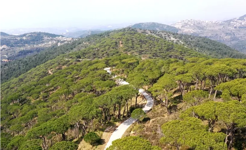
This trail leads you through several beautiful villages while experiencing stunning 360° views of the entire region. It starts at the municipality of Jezzine, through the Souk el Sed, Ain Toughra and the village of Haytoura to visit the St. Anthony’s Church. You will then head through olive groves and grazing cattle, passing a pine forest before reaching the Kaytouli village where you will visit the village fountain, the St. Michael Church and the St. Georges Church.
Steps & Interest Points
Departure from the municipality of Jezzine
This trail begins at the municipality of Jezzine, a remarkable building dating back to 1898. Take a stroll through the Souk el Sed which features some charming traditional stores where you can pick up artisan bread and dried fruits. Head up an asphalt road for 1 km until you reach the top of the Ain Toughra hill for a splendid panoramic 360o view of Jezzine, Mount Hermon and Mount Sannine.
Heading to a massive oak tree
Head south, passing an imposing cross monument, through dramatic rock formations to view the village of Haytoura in the valley below. Continue on track road, then head into the wild to take a trail which leads to a massive oak tree under a cliff with a wooden cross – a great spot to take a rest in the shade. Continue through challenging rough terrain to reach the Haytoura village stairs. Visit St Anthony Church, the village water fountain, and remnants of the Vichy occupation, then head to the Cafe Cheer for a refreshing drink and a snack.
Meadow, pasture and olive grove
From here, walk towards the valley, head through olive groves and grazing cattle, passing a pine forest. Continue east on a stony trail towards the village of Kaytouli through a meadow, in spring a blanket of wildflowers. Then through trees to reach an asphalt road, take a right to a gravel road until it splits. Head up on a stony mountain path, along a fence, then head down to pass over the El Jouze stream, through an olive grove. Take a right to reach the El Rabiha stream.
To the village of Kaytouli
Make your way through ferns and scrubs to reach towering pine trees and continue right to reach an asphalt road which will take you to a restaurant in the woods offering local delicacies, a lovely spot for lunch. Continue to the village of Kaytouli to visit the village fountain, the St Michael Church and the St George Church. Admire the panoramic view from the courtyard and take a stroll through this charming village featuring traditional houses. End your hike here or continue hiking on The Kaytouli Coal Mine Trail.
Reviews (0)
+
Login to post a comment
Trailhead Location
Municipality of Jezzine
Jezzine +
Jezzine District, South Governorate
Lebanon
Trail caracteristics
Elevation Minimum:
882 m
Elevation Maximum:
1204 m
Elevation Average:
1055 m
Total Distance:
9.45 Km
Maximum slope:
35.5%, -45.7%
Average slope:
8.1%, -12.2%
Tips
Take a hat or a cap
Take a water bottle
Wear comfortable shoes
Wear comfortable clothes